DETAILS
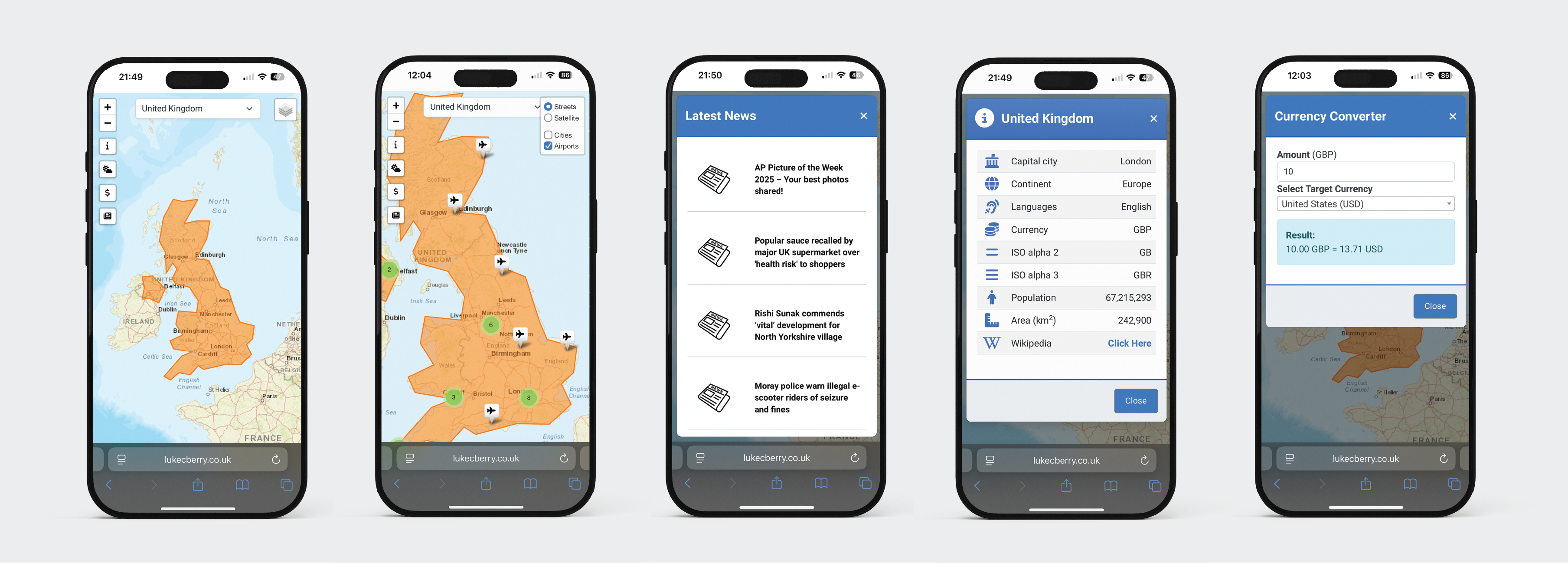
This interactive map project provides an engaging way to explore geographical data. Users can select a country from the dropdown menu to dynamically view detailed information about the selected region. Features include city and airport locations, a country overview, current weather updates, and the latest news. Additionally, a built-in currency calculator enhances the experience, offering practical functionality alongside the geographical insights.
LANGUAGES/FRAMEWORKS USED
- • HTML
- • CSS (including Bootstrap)
- • JavaScript (including jQuery)
- • PHP